Harvesting Is The Hard Part
Open data work usually breaks on synchronization, portal quirks, and stale records before search even starts.
Open data is scattered across thousands of portals speaking different APIs. Ceres harvests CKAN, DCAT, SPARQL, data.json, Socrata, OpenDataSoft, and ArcGIS Hub sources into one synchronized PostgreSQL catalog — then layers embeddings, semantic search, exports, and a public index on top, only when you want them.
Named after the Roman goddess of harvest and agriculture.
Harvesting Is The Hard Part
Open data work usually breaks on synchronization, portal quirks, and stale records before search even starts.
Portals Are Fragmented
CKAN, DCAT, SPARQL, static data.json, Socrata, OpenDataSoft, and ArcGIS Hub portals expose different capabilities, languages, and reliability profiles. Ceres speaks all of them.
Embedding Should Be Optional
Many teams need a trustworthy harvested catalog first, then decide later whether to add local or hosted embeddings.
Ceres is designed around that order of work: harvest first, embed later if useful, search once the catalog is ready.
Stream metadata from CKAN, DCAT (udata REST, SPARQL, static data.json), Socrata, OpenDataSoft, and ArcGIS Hub portals into PostgreSQL, track sync history, detect stale datasets, and keep the catalog current even when embeddings are disabled.
Harvesting and embedding are separate services. Run metadata-only syncs, backfill embeddings later, or switch provider without re-harvesting your sources.
When you do want vectors, Ollama gives you a local zero-cost path. Gemini and OpenAI remain supported, but the project no longer assumes cloud embeddings are required.
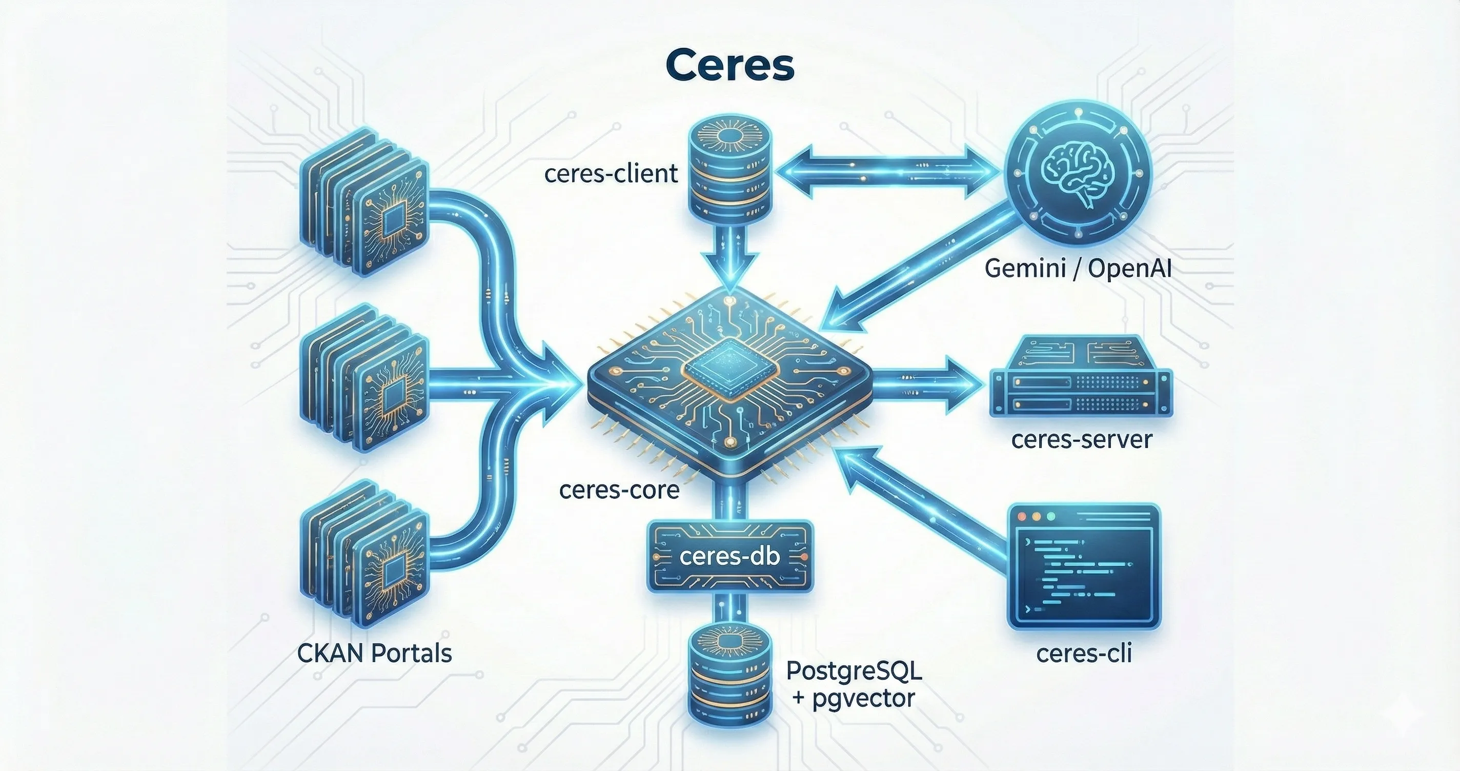
Use ceres harvest to populate the catalog, optionally in metadata-only mode. Incremental sync, delta detection, and stale marking reduce churn and keep memory bounded.
Run ceres embed when you want vectors. Ollama is the preferred local option; hosted providers are still available for teams that want them.
Search, API access, Hugging Face snapshots, and downstream analytics all build on the same harvested catalog.
Coverage foundations: OpenDataSoft Explore, ArcGIS Hub, Project Open Data data.json, OGC CSW 2.0.2, and collection-level STAC harvest paths — plus opt-in per-profile live smoke checks and a reproducible metadata-only coverage validation set.
Resource-level metadata depth: first-class distribution and schema tracking across every harvest path, surfaced in published snapshots and the API.
A trustable published index: versioned snapshot manifests, integrity checksums, coverage and quality reports, duplicate/source-alias semantics, and snapshot changelogs.